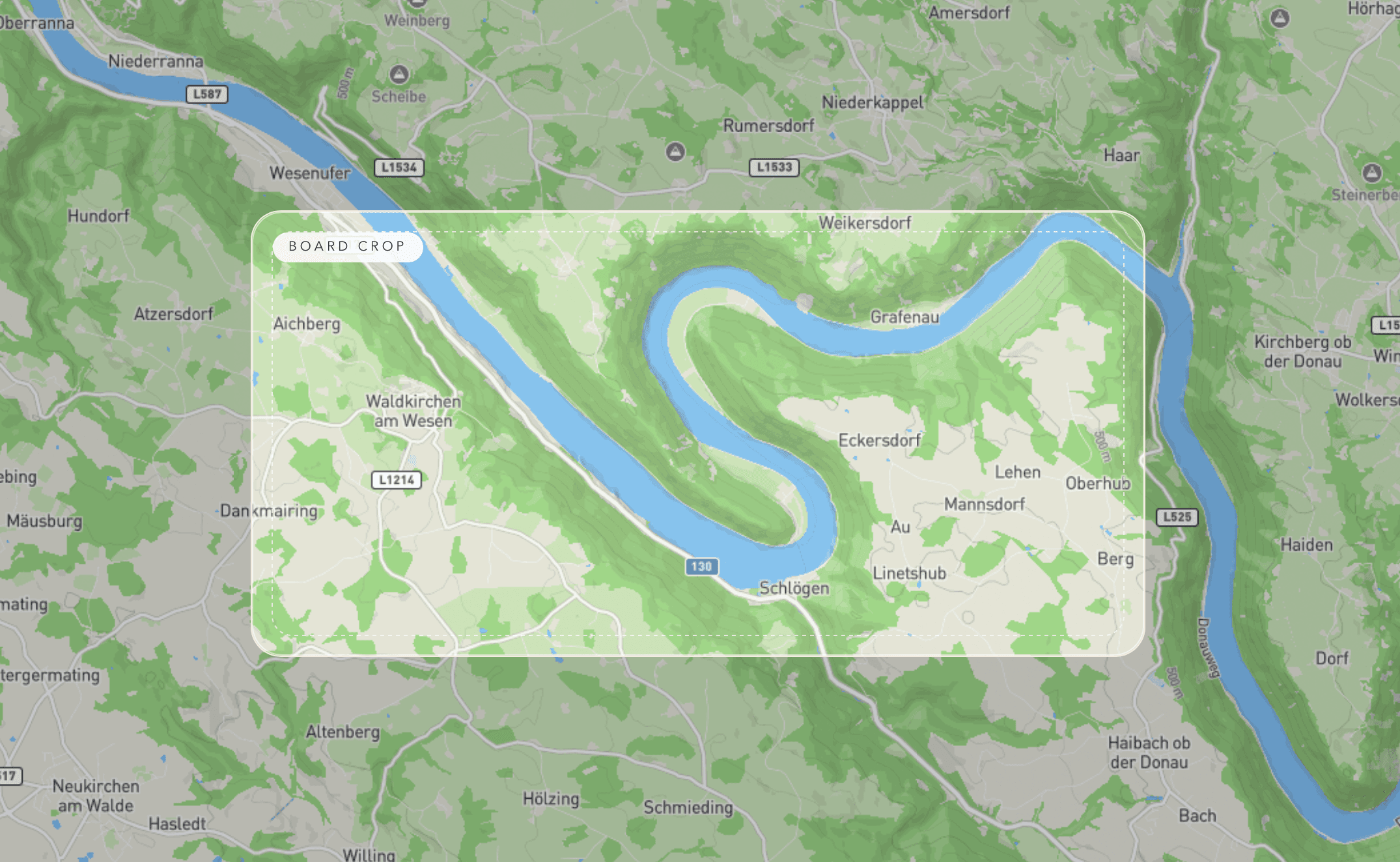
01 Live crop
Frame the exact board crop
Move the live map underneath the fixed board frame until the bend, coastline, lake, or ridge lands exactly where you want it.
Layered Maps is a web app for makers and studios building layered wood maps, relief art, and location-based gifts. Frame any place, set the board size and stack, then export laser-cut SVG files and UV-print PNG layers from real terrain data.


These are the actual screens and a real fabricated result from the same Layered Maps process: frame the crop on the live map, adjust the stack, create the exploded preview, then laser cut, UV print, and assemble the final object.
Move the live map underneath the fixed board frame until the bend, coastline, lake, or ridge lands exactly where you want it.
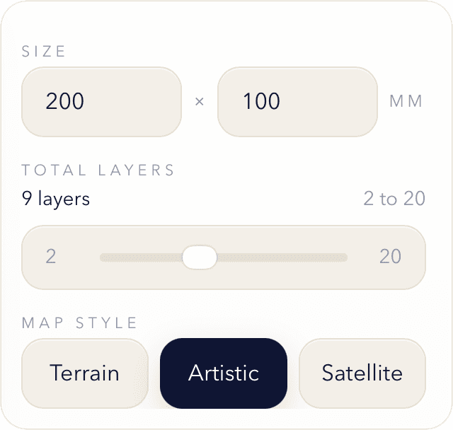
Set the board dimensions, choose the total layer count, and switch the map style before you lock the composition into the preview.
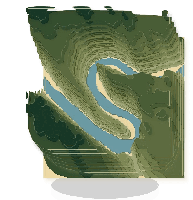
Generate the exploded view to check how the separated layers stack, where the relief reads best, and whether the build feels right before fabrication.
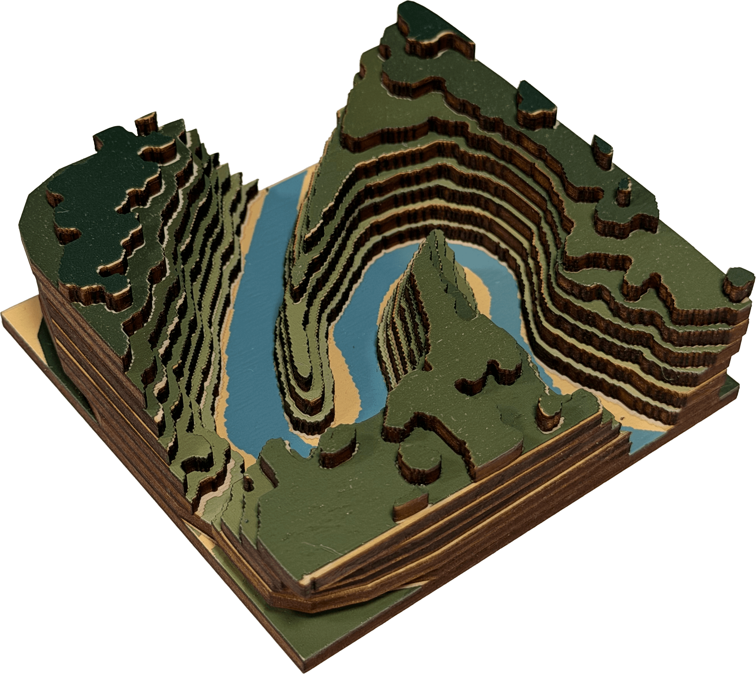
The exported SVG and PNG files become a real layered object with the same terrain structure, water shapes, and printed surfaces you approved on screen.
Keep the same geography and layer geometry while switching between Terrain, artistic, and satellite presentations depending on how literal or decorative the final map should feel.
Graphic topographic relief with bold color blocking for statement pieces, showroom samples, and modern wall maps.
The most cartographic option, keeping roads, cities, water, and relief readable across a larger custom map region.
Photographic surface detail for coastline, alpine, and travel-driven maps while the layered geometry stays production-ready.
Every plan includes the core terrain-to-export workflow. Higher tiers raise the monthly project limit and unlock more visual styles for paid client work.
A small non-commercial plan for personal builds, gifts, and testing the full terrain workflow.
The working plan for makers selling finished boards or taking on regular client projects.
For higher-volume production, repeat orders, and teams iterating on many boards every cycle.